Download this guide as docx
Welcome
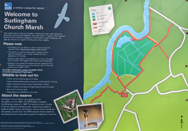
This small nature reserve is a great place for marshland bird watching on a circular walk around reedbeds, fens and pools. In spring and summer, marsh harriers, kingfishers and warblers can be seen, while wildflowers provide a riot of colour. The site floods regularly in winter, attracting a variety of waterbirds.
Read more at https://www.rspb.org.uk/reserves-and-events/reserves-a-z/surlingham-chur...
Level access
Access with steps
There are steps from the main entrance to:
Non RSPB boardwalk used to complete the circuitGetting here
For further information on accessible travel in Scotland, go to Transport Scotland.Travel by public transport
Konectbus Service 85 leaves from Norwich Bus Station several times a day Monday to Saturday - www.konectbus.co.uk/Timetables and Services. The stop is listed as 'Surlingham Pond'.
Arriving from Norwich, continue in the same direction on School Lane. There is pavement for the first 40m of the route which uses country lanes. The lane initially slopes gently downhill and is cambered in parts. After 460m (at the bottom of the hill) turn left on Bramerton Road uphill for 335m and take the turning for Church Lane on the right, signposted 'Surlingham Church'. The church gate is 100m ahead, there is seating in the curch porch. The path to the reserve trail starts 60m past the church.
Travel by taxi
Parking
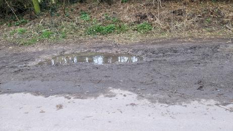
There is no official rspb car park for this reserve, but parking may be found nearby in the layby opposite the church, before accessing the start of the trails. However, the surface is bare earth and potholed and uneven in places.
Arrival
Path to main entrance
Main entrance
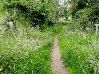
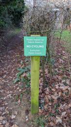
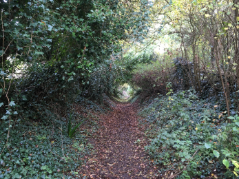
There is a narrow sloping path to the start of the rspb managed part of the trail. The path is 130m long and uneven with a layer of leaf litter and twigs on the surface in winter. The path is marked by a green 'No Cycling' sign on a post where the main track bears right in front of a cottage.
Getting around inside
Getting around outside
Surlingham Church Marsh
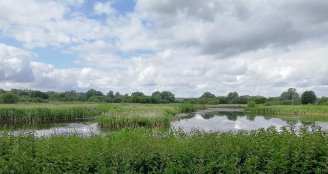
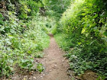
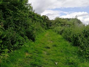
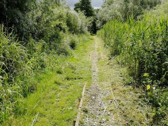
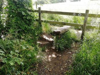
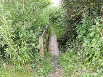
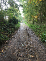
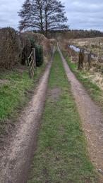
The rspb trail is accessed via the narrow path described above and forms a loop, returning to the parking area. The return section is not RSPB managed. The trail is subject to regular flooding due to its low lying position and can be very muddy, . The trail is uneven and has a stile and footbridge at one end. There are 2 seating oppportunities, a bench at 540m and the Surlingham Shelter at 1020m. This is an open fronted viewing shelter, with no doors or windows. It provides a sheltered place to enjoy the broad and reedbed. The last section of the loop is on a rutted farm road for approx. 800m.
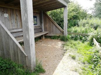
Surlingham Shelter
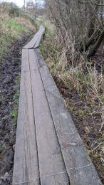
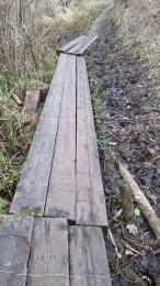
Non RSPB boardwalk used to complete the circuit
The non-RSPB boardwalk is accessed via the stile, pictured above. The boardwalk is currently flood-damaged and in hazardous condition. Some supports have detached from the boardwalk, leaving it extremely uneven. The boardwalk is due to be replaced and this guide will be updated when the work is complete.