 Download this guide as docx
Welcome
This small reserve provides views over Rockland Broad, the River Yare, reedbeds and open grazing marshes.
Getting here
For further information on accessible travel in Scotland, go to Transport Scotland.Travel by public transport
Konectbus Service 85 leaves from Norwich Bus Station several times a day Monday to Saturday - www.konectbus.co.uk/Timetables and Services. The stop is listed as 'Rockland St Mary, Surlingham Lane'.
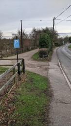
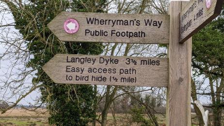
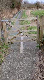
The bus stop is 760m from the start of the path but 1520m from the RSPB part of the path. Arriving from Norwich, head 5 metres back to the corner, turn left along The Street (which becomes New Inn Hill). The tarmac pavement is level, narrowing to 700mm in places. The reserve turning is just after The New Inn. There is no RSPB signage, there is a sign for the Wherryman's Way Public Footpath on a fingerpost.
Travel by taxi
Parking
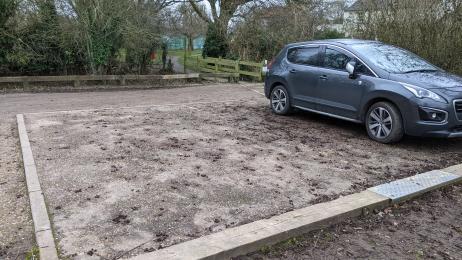
The car park is not owned or managed by RSPB, but can be used to access the path to the reserve. The entrance is just before the New Inn, parking is free.
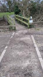
There are 2 accessible spaces at the far end of the car park with a level tarmac surface. A short tarmac path leads from these spaces to a footbridge (1200mm clearance) with a short 1040mm wide aggregate footpath beyond, leading to the pavement and reserve turning.
Arrival
Path to main entrance
Main entrance
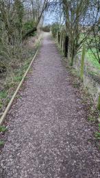
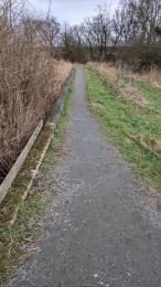
From the (non RSPB) car park a path can be accessed which is part of the Wherrymans Way public footpath, the RSPB managed part of the trail is 880m from the car park. There is no official entrance to the reserve and there are no facilities on site. The viewing hide - 1020m from car the park - is currently closed. The broad can be viewed from a bench 180m past the hide. The path surface and width changes throughout the trail.
Getting around inside
Getting around outside
Rockland Broad Trail
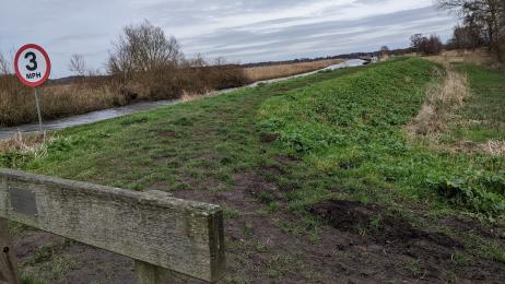
The hide is currently closed, the broad can be viewed from a bench 180m past the hide. This is the only seating on the trail.

Rockland Hide
Rockland Broad Trail (Further Info)
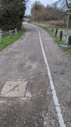
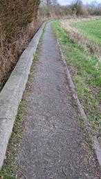
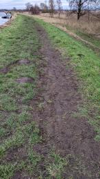
The distance from the reserve turning to the hide is 1020m, mostly level compacted aggregate with a metal kerb, 1100mm wide at it's narrowest point, including the kerb. The next 180m section leads to a bench with views over the broad. This is the same surface but slightly less level and 1050mm wide in parts. There is a short earth ramp at the bench which leads to a raised, wide grassy footpath to the river. This section is 560m long and can be muddy and soft.